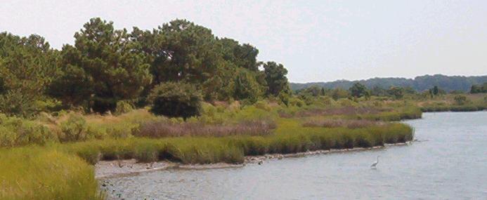
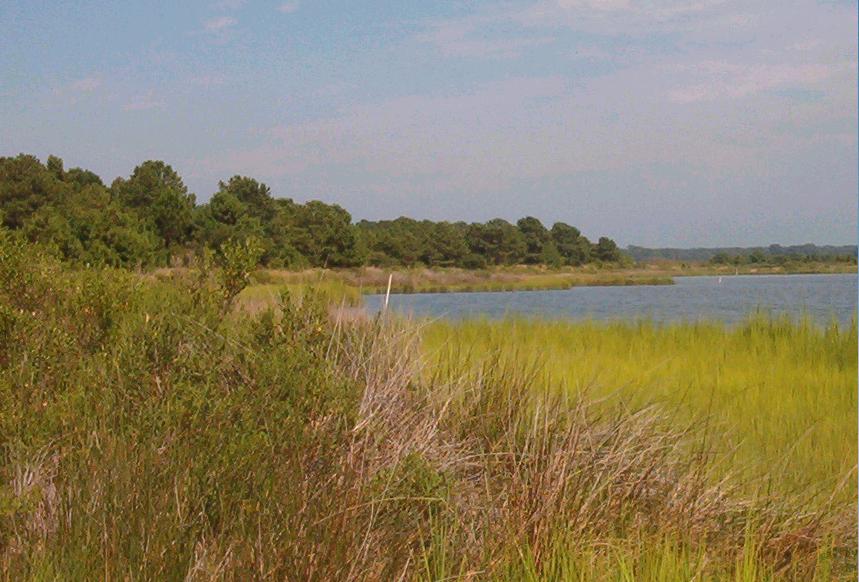
Above you will see the area that we are about to tour. It is the 70 acres of wooded-wetland
and beach areas at the mouth of the Lynnhaven River and Chesapeake Bay that began its life in the early 1970's as a sand removal
site from the dredging of the Lynnhaven River (just like the Chesapeake Beach receives dredged sand) However, this area
has across 25 undisturbed years thru the action of natural forces of wind, tidal water flow and rain, colonized
and established itself into a traditional wetland. It is, in fact, the last of its kind at the Chesapeake Bayfront. Notice
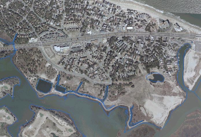
the blue markings that outline RPA wetland buffer areas that are protected by the laws & ordinances of the
Chesapeake Bay Preservation Act of 1991 and from which 100 ft. back extend the most sensitive wetland
areas under lawful protection from disturbance. The deveoper has in fact asked for a release from these laws due to hardship
(wanting to build across and directly on these protected wetland areas in order to maxmize density and profit)
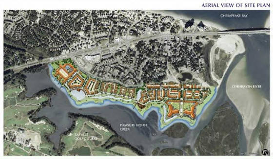
Below, you will see what the Indigo Dunes project is
proposing after a base of
7-10 feet high landfill
has been dumped and graded to cover every inch of this area and its inland tidal waters as fill for foundation.
This will effectively destroy every single tree and form of vegetation that has been 1) a refuge for wildlife
and 2) a large natural filter buffering the wetland waters from drainage and run-off. It will kill every single wildlife
animal and bird living in this refuge area as well as nearby marine and aquatic life (crabs, oysters, mussels) that
live in the tidal marsh and inlets.
The results will not be fully realized until it is far too late, no matter what
the "experts" are saying now. There WILL be a net load increase in
pollution, irregardless of the claims made that there will be "minimal to no" impact with the use of "mitigation"
methods. (And how or who will measure that 5 years from now, and then do what to fix?)
The devastation will be permanent and costly. Its full impact will
not be seen until at least 5-7 years out. This is an average estimate of time taken for environmental damage to reach
its full impact on the river and adjacent areas once all original vegetation and root systems have been destroyed along with
the surrounding animal and marine-aquatic life. Essentially, an entire ecosystem will be removed. The paid
for study "experts" in fact have little to no idea what it's real impact will be, apart from the actual and eventual truth:
devastating.
Numerous studies, advisory groups, citizens and other personnel
have consistently told the city the same thing: 1) preserve your open, natural green space in the Shore Drive
corridor and 2) manage/restrict any further density-development in the corridor to protect the integrity of the
Chesapeake Bayfront and the safety of it's community.
What is it going to take? Now is the time to take a stand!